


STEVENSON Le Monastier - Saint Jean du Gard

Kargil
User GUIDE

Length
235 km

Max alt
1699 m

Uphill gradient
6445 m
Km-Effort
323 km

Min alt
233 m

Downhill gradient
7065 m
Boucle
No
Creation date :
2018-09-24 18:08:05.252
Updated on :
2020-11-08 19:56:50.035
--
Difficulty : Difficult

FREE GPS app for hiking
 SityTrail
IGN / Geographical institutes
SityTrail Plus
The world is yours!
About
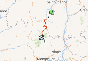
Trail Walking of 235 km to be discovered at Auvergne-Rhône-Alpes, Haute-Loire, Le Monastier-sur-Gazeille. This trail is proposed by Kargil.
Description
Le chemin pour les puristes du Monastier à Saint Jean du Gard. Toutes les étapes sont détaillées par ailleurs avec en prime le départ du Puy et l'arrivée à Alès.
Positioning
Country:
France
Region :
Auvergne-Rhône-Alpes
Department/Province :
Haute-Loire
Municipality :
Le Monastier-sur-Gazeille
Location:
Unknown
Start:(Dec)
Start:(UTM)
578457 ; 4976745 (31T) N.
Comments